Trail Maps & Parking Info
Section 1: Mile Marker 0 to Mile Marker 8
General Information
Trailhead address: 10431 Bloomsbury Road, King George, VA 22485
The Bloomsbury Road Trailhead serves as one of the Dahlgren Trail's primary access points and is a popular starting location for many trail events. With ample parking and easy access to miles of crushed-stone trail, visitors can enjoy a scenic ride or walk through woodlands, wetlands, and open countryside while experiencing the rich history of the former railroad corridor.
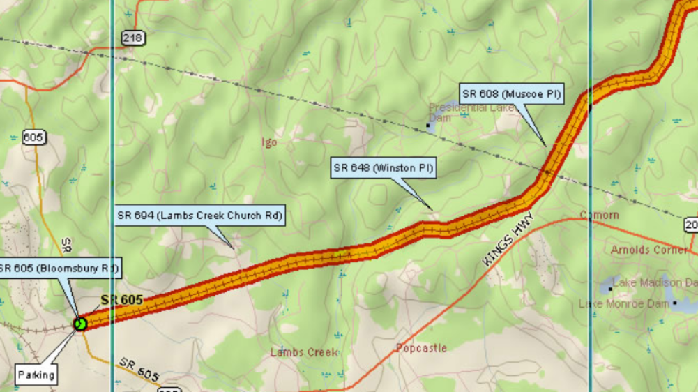
Section 1 of the trail encompasses approximately 8 miles, and spans from the State Route 605 (Bloomsbury Road) trailhead to State Route 610 (Indiantown Road). The trail is clear and the historic railroad ties are removed. The natural surface is even and good for walking, hiking, biking, and running. The first four miles are particularly well used, maintained, and are suitable for strollers and children.
Parking & Access
Always park so as not to block in other trail users. Never park in such a way that blocks the gated entrance to the trail itself; you will be towed.
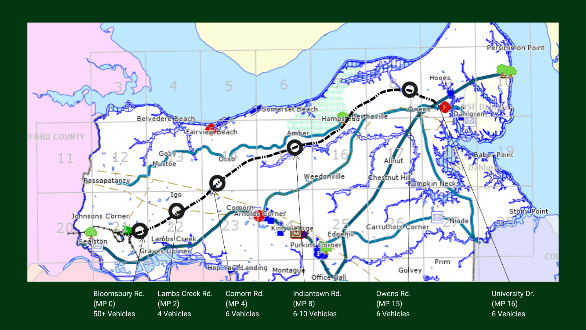
Rt. 605 Trailhead: When security gate is open, there are approximately 50+ parking spots available; when the gate is closed, 2-3 vehicles can park outside of the gate on the left hand side.
Rt. 694 Road Crossing: 1-2 vehicles can park off the road on each side of the trail.
Rt. 609 Road Crossing: Located at 9274 Comorn Road - there is a small parking lot on west side which can hold 6 cars. From Rt. 3 East, turn left onto Comorn Road, take the right side of the fork, and then turn into the gravel parking lot on the left side of the road.
Rt. 610 Road Crossing: Up to 5 vehicles can park off the road on the eastern side. Please be sure to park completely off the road and do not trespass on neighboring property.
Section 2: Mile Marker 8 to Mile Marker 12
The first mile segment of this trail section is leveled and surfaced with stone dust. This segment is terrific for strollers as well as children with bicycles and is perfect for easy walking as well as hiking and running. The rest of this trail section is clear, and the railroad ties have been removed, but the entirety of the section has not been completely leveled and stone dust has not been laid in all spots.
Parking & Access
Rt. 610 crossing: Up to 5 vehicles may park off the road, on the east side of the trail.
Notes: There is no public trail access from The Meadows (all roads are private). Roads along Rt. 218 (Salisbury Retreat, Abingdon Lane, etc.) are also all private.
Please be sure to park completely off the road and do not trespass on neighboring property.
General Information
Trailhead address: 6493 Indiantown Road, King George, VA 22485
The Indiantown Road Trailhead offers a convenient starting point for exploring the eastern portion of the Dahlgren Trail. This section features a mix of shaded forest, open landscapes, and abundant opportunities for birdwatching and wildlife viewing. Recent improvements to the parking area have made this location even more welcoming for trail users.
Section 3: Mile Marker 12 to Mile Marker 16 (End)
General Information
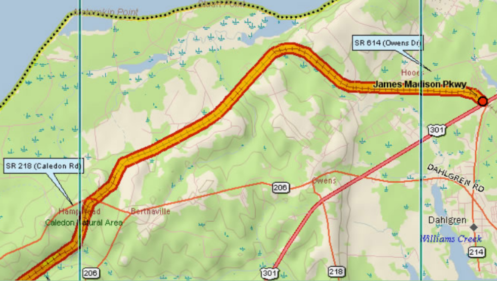
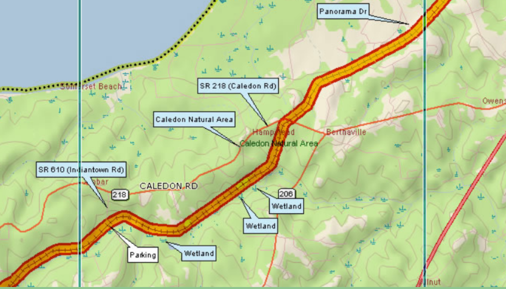
Section 3 of the trail begins approximately 4 miles from Panorama Drive in The Meadows subdivision and continues to just off Rt. 624 at Owens Drive. Located near the center of the Dahlgren Trail, the Owens Drive Trailhead provides easy access to one of the trail's quieter stretches. This section is ideal for walkers, runners, cyclists, and families looking for a peaceful outing surrounded by forests, wildlife, and the historic railroad corridor. Whether you're planning a short stroll or a longer adventure in either direction, this trailhead offers convenient access to the heart of the trail.
Parking & Access
There is a small parking lot where the trail crosses Owens Drive with room for 3 cars on each side of the road. Parking is permitted at the back of the Little Ark Baptist Church parking lot during daylight hours, except on Sunday mornings; trail users are not authorized to access the trail property that passes adjacent to the church's cemetery. A temporary bypass has been created to go off the trail and around the cemetery. Please follow the flagged trail to the north side of the existing rail bed. A pipe blocks the trail at the western side of the bypass, and the eastern end is just past a private driveway. Please be sure to park completely off the road and do not trespass on neighboring property.