|
Written by Ian Littlejohn
BACKGROUND In the early 1940's, the Navy commissioned the establishment of the Dahlgren Railroad to Dahlgren for transportation purposes. A series of plats was engineered showing the layout, location and elevation of the terrain over which the railroad bed would ride. Since the railroad bed itself needed to be mostly level with minimal slopes (grades), large quantities of fill were required to allow for a level road bed. With the addition of the fill, drainage-ways and streams became blocked, causing wide-spread flooding on adjoining properties as streams were dammed up and closed off. Engineering was performed to calculate water flows and run-offs. Using that data, suitably sized culverts were installed at locations where water would build up. This information was documented in those plats. As computers became available, the original survey work from the 1942 era was transferred to Navy computers. That data may be lost today. However, several years ago, hard copies of the original 1942 plats were obtained and scanned into electronic files for easy use. Those files are now available on the Dahlgren Trail website. Both elevation data and distance data is shown on the plats, but the distance information is shown in “Stations”, which is commonly used and understood by people who build roads but not by everyday people who use feet and miles. The stationing system is very easy to understand once the method is explained. One “station” represents 100.00 feet. So station 10 is 1000 feet down the road from Station 00, which is the beginning. NOW Several years ago, the Dahlgren Trail established a mile marker system to be used for distance identification purposes and races. The problem arises that the mile marker system’s accuracy is not known and was not correlated to the stationing system used during railroad construction. Work is now being done to correlate the two systems. An effort is also underway to identify and catalog the various culvert locations, sizes, and types using the mile marker system into a general maintenance table. A maintenance issue arises when culverts are used - they must be kept clear of debris and kept clear so adjoining lands are not flooded if a culvert gets clogged. The Navy, according to a local land owner, hired a contractor to do that work. Since culvert details are identified on the Navy plats by “Station”, not by mile marker, work is hard to perform. Using the mile marker system will allow Dahlgren trail maintenance personnel to better manage the maintenance of the culvert system to preclude damages that might occur if culverts become clogged with debris. For example, there are two culverts just west of MM-0 that are not even identifiable as culverts due to clogging. But they are shown on the Navy plat. Once all culverts are identified and located by mile marker, people who assume maintenance of sections of the trail can monitor the culverts in their area for issues. Trail management teams can take any required action to keep the drainage system functioning properly and safely.
2 Comments
 #GivingTuesday is a monumental day of opportunity for nonprofit organizations all around the world. It is a global movement that unleashes the power of dedicated people and organizations to transform their communities. This movement includes us - the Friends of the Dahlgren Railroad Heritage Trail - and every person who has treasured this slice of paradise in King George County, VA. As a group of passionate volunteers who are an active voice for the trail, we ask you to join forces with us to ensure that #GivingTuesday and the entire #GivingSeason make a lasting, positive impact on this place we cherish.
Funds raised during #GivingTuesday and #GivingSeason will be directly used to improve access and user experiences on the trail. We are planning an expansion of parking and trail access areas, improvement of fire pits and camping spaces, consistent trail maintenance, and the sharing of relevant news and trail updates within the trail's information kiosks. If you share our passion for the trail, please donate on December 1st and share our fundraiser with your friends and family using Facebook and Instagram. "Like" our page and follow along as we pursue our goal of raising $5,000! 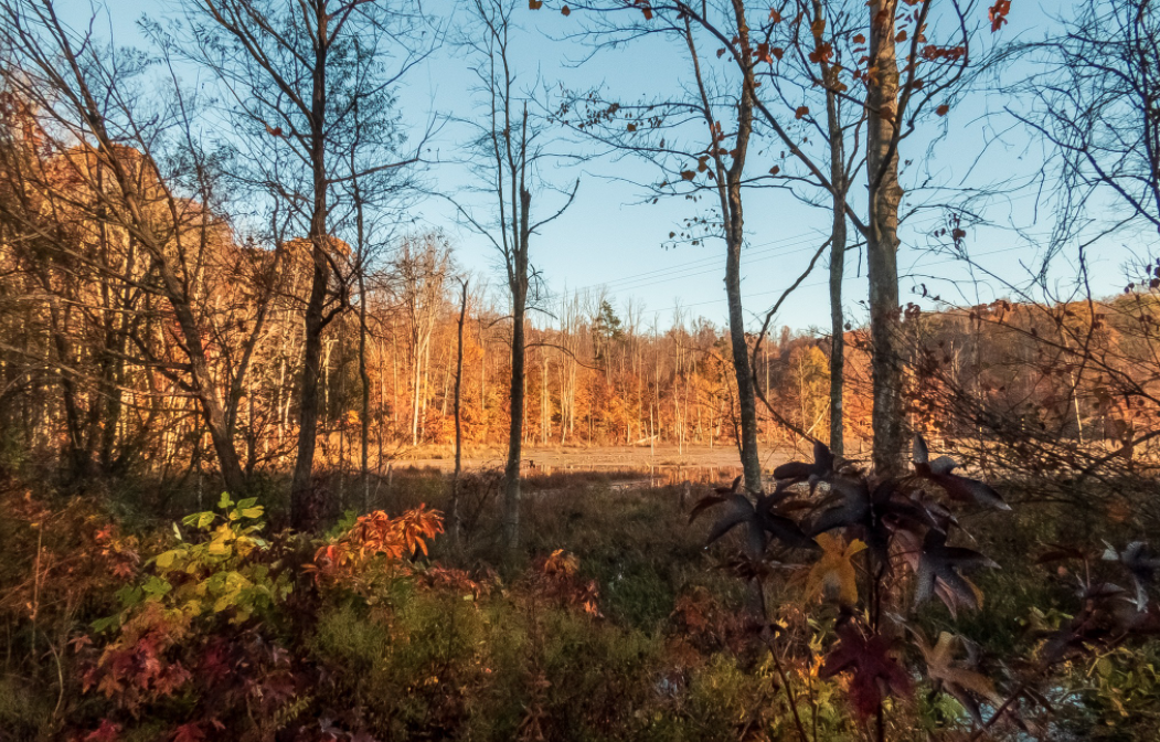 Fall colors on the Dahlgren Trail. Photo (C) Chris McClintock, 2020. By Jim Lynch, president, Friends of the DRHT
It's been a busy month on the trail. We had rain interspersed with some nice days. Our friend and expert photographer Chris McClintock is out there almost every morning taking fabulous photos, which she posts on her Facebook page. Check them out — especially if you aren't lucky enough to be able to visit the DRHT daily. 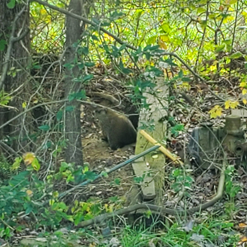 This fellow — or gal, we don't know gender — is making its home on the DRHT near the caboose.
Since it has adopted the trail, we figure we should adopt it in return. Help us name our resident groundhog. Send us your suggestions and we'll share the favorites for a vote. Thanks to Warren Veazey for the portrait of the groundhog in its home environment. |
AuthorWrite something about yourself. No need to be fancy, just an overview. Archives
June 2024
Categories
All
|
 RSS Feed